LOCATION
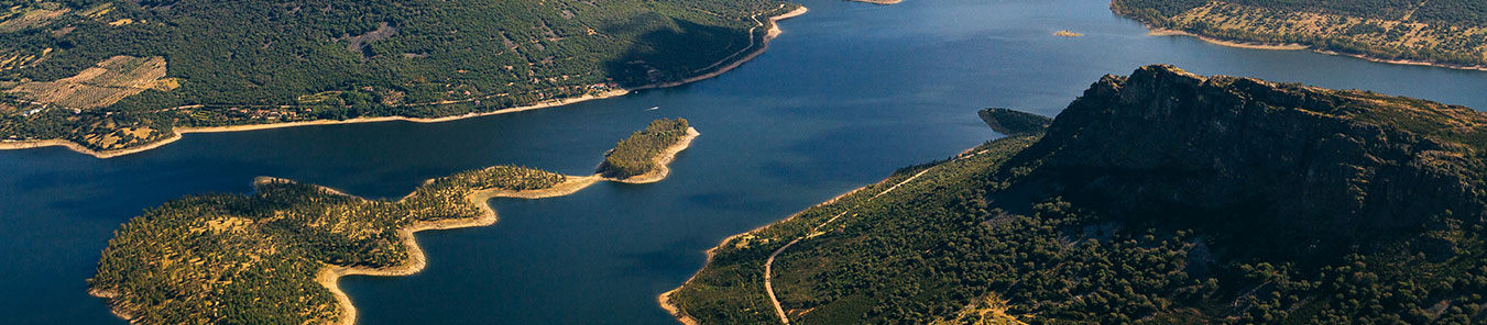
The region of La Siberia is geographically located in the northeast of Badajoz, thus limiting Cáceres, Toledo and Ciudad Real, in addition to the province of Cordoba at its southern end. Surrounding Siberia other regions of Extremadura: the Caceres region of Las Villuercas in the north and La Serena in the south and the west pacense. This is acountryside surrounded by mountainous foothills —with the exception of the eastern area, crossed by the Guadiana—, whose mountainous area constitutes a southern spur of the Montes de Toledo, in connection with the village of Las Villuercas. The Sierra de los Golondrinos, very close to the town of Herrera del Duque, is one of these foothills that constitute the geomorphological junction of Badajoz with the districts of Ciudad Real. Shire of rustic charm, given by the broken, flat or mountainous fields that make up its orography, delimited by irregular terrain is —scrublands, shales, peneplains— and poor and shallow soils, with numerous rocky outcrops. The northern area is rugged by the foothills of the Montes de Toledo, the southern, flatter, by the Sierra Morena. It counts the area with deforested areas, although it stands out above all for the large presence of water pockets, being characterized by its reservoirs —The Serena reservoir is the largest existing water bag in Spanish territory, and the second largest in the Iberian peninsula, only surpassed by the Alqueva reservoir in Portugal; In addition to having Siberia with other reservoirs of gigantic size, such as Orellana , all of them rich in fishing of all kinds— which take advantage of the rivers Zújar and Guadiana , and delimit the orography of these places, a combination of pastures, valleys, pastures , olive groves, agricultural lands and diverse extensions of water such as lagoons, wetlands, springs and channels. Not in vain does it allude to its condition of "internal sea", given the numerous kilometers of sweet coast that the region has, to the point of being the territory with the largest number of kilometers of inland coast in Spain thanks to its innumerable rivers, swamps and reservoirs.
There is also a great presence of flora and fauna in La Siberia. The existence of places like the Regional Reserve of Hunting of the Cíjara favors the possibility of contemplating the existing biodiversity. Deer, wild boar, as well as diverse birds —the range goes from protected species such as the Egyptian vulture and the eagle owl to other more common ones such as turtledoves and partridges— when it comes to wildlife; cork oaks, heather, rockrose and varied trees in what concerns the flora. Numerous game reserves can be found in the region, thanks to the preponderance of low bushes, rock roses, holm oaks, all of which are very suitable for hunting activities. But it is not only the natural habitat in which the visitor can delight, but also has to be recreated in the historical character of the region, which still has numerous vestiges of the past that range from cave paintings,Celtic castros and Roman and pre-Roman ruins to castles of the medieval Christian , imprints of the Arab domination and other archaeological features of great interest. It is also present in La Siberia the history of ancient manors, of great lineages and duchies: Altamirano, Bejarano, Orellana, Osuna ... whose footprint still persists through monumental evocations, manor houses and similar. And the importance of the region for the Mesta can not be ignored either, where routes of transhumance converge in its places, through the Segovian, Soriana and Leon glens.
MAP OF LA SIBERIA
In the following map of the region of La Siberia, you will find geolocalized the different locations, reservoirs, beaches, fishing areas, viewpoints and hiking routes, in order to generate an optimal interactive experience in your visit to our website.